
.
Check out some customer 100 usage examples. Find out below if S100 is suitable for you.
*** Customer Usage Example Start ***
From a Customer in USA
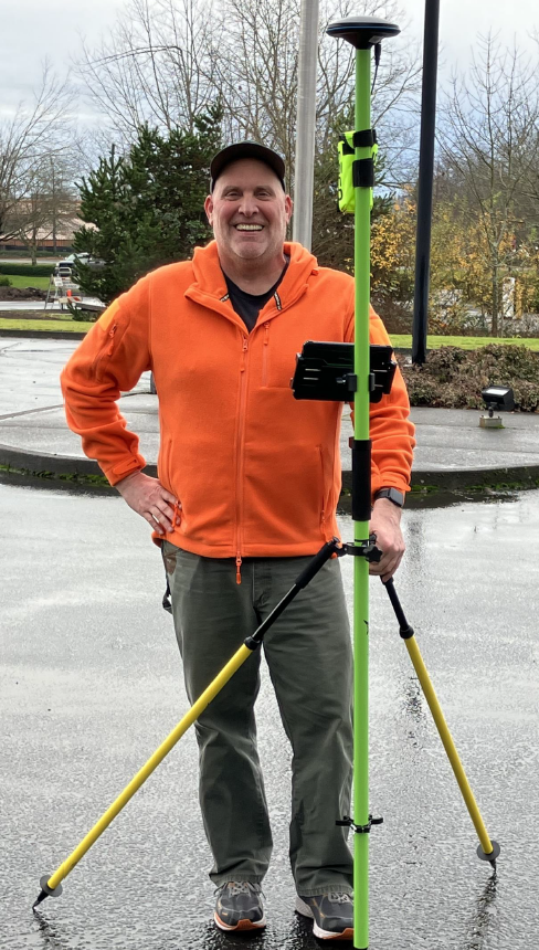
My name is Kurt Andersen, I work as a Project Surveyor for a Department of Transportation in the United States. I use my S100 for Topographic-Boundary-Utility Surveys, Construction Layout and as a Static Base. It is used primarily as an RTK Rover using a Public NTRIP service. We use it as a Static Base to collect 4-hour sessions to support the GPS on Benchmark campaign for the upcoming NGS datum update. The Polaris RINEX conversion tool works great for submitting data to the Online and submitted to OPUS (Online Positioning User Service). When OPUS begins accepting Glonass and Galileo constellations we will be ahead of the game, the S100 is already tracking those systems.
I have the S100 set-up with an 8” Rugged Tablet with a SIM card to connect to the internet. I use a Real-Time GPS Network (ORGN) with a Correction NTRIP across the internet. We are easily able to achieve the Horizontal (7mm) and Vertical (14mm) accuracies that are advertised for the S100. I have tested the repeatability and accuracy of the S100 on existing control across the state, and it has performed spectacularly. It provides consistent survey grade data when using a correction service.
The benefits of the S100 for us are cost, size and versatility. Our department has been using Standard FieldGenius for 8+ years on more than 70 Windows based devices. The FieldGenius for Android application paired with an S100 is a very strong option to replace our older devices. It is much lighter, faster and versatile.
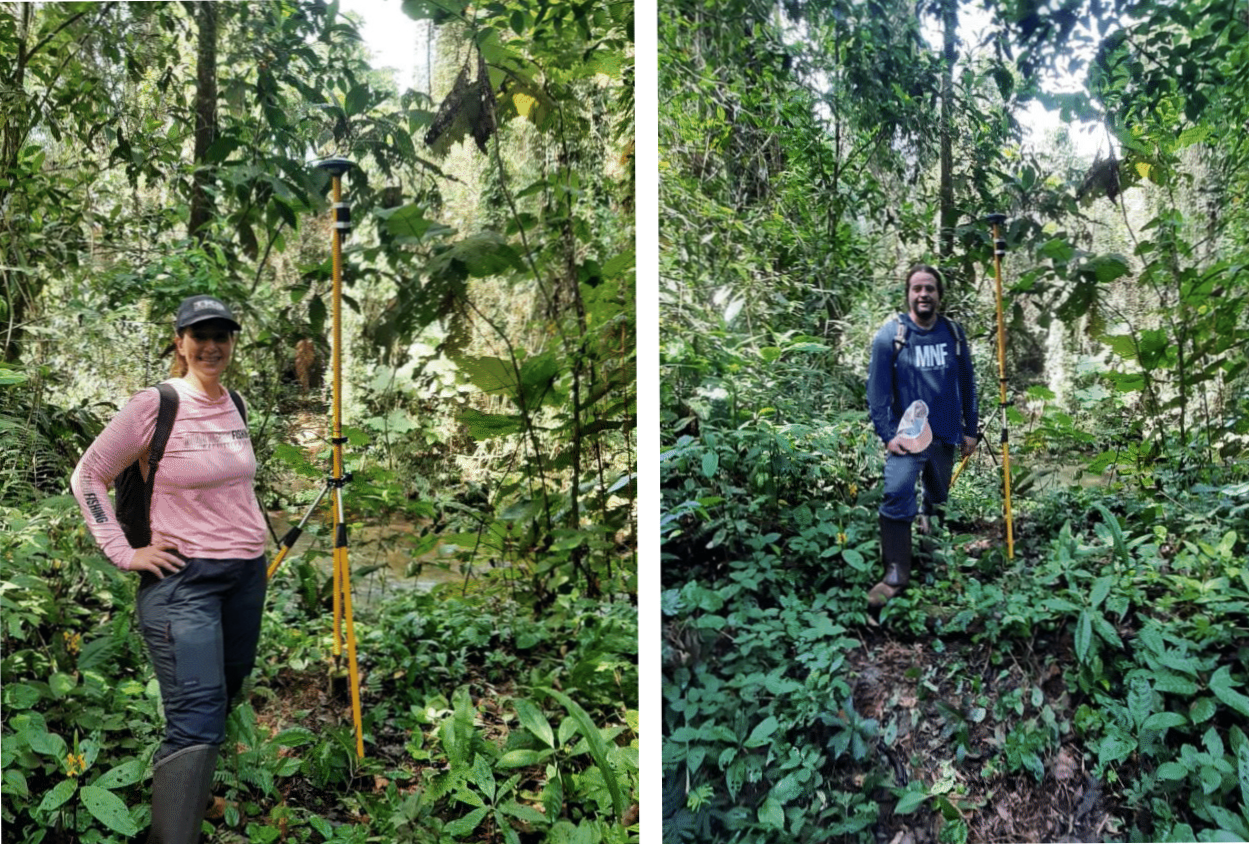
From a Customer in Brazil
*** Google Translation to English***
My name is Guilherme G. A de Carvalho, I am a Geographer, Surveyor Engineer, owner of the company Terra Uso Ambiental, and together with my wife Thais O. Basso, Forestry Engineer, we work in various topographic services, such as planialtimetric survey, rectification of properties, adverse possession, dismemberment, georeferencing, SIGEF, leasing, staking of works, study of areas, subdivision, REURB, real estate registry, geoprocessing, geographic database, rural environmental registry and environmental studies.
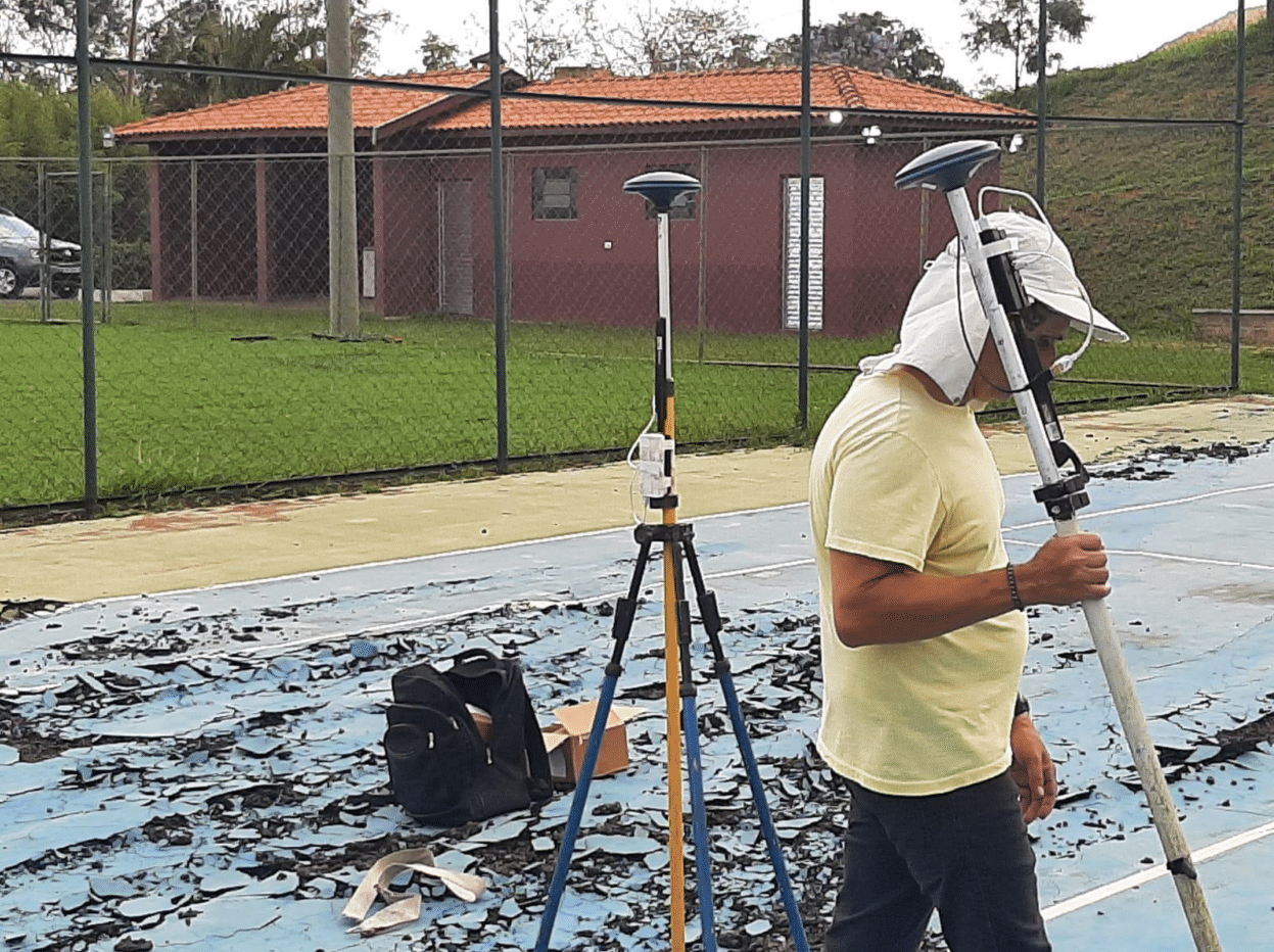
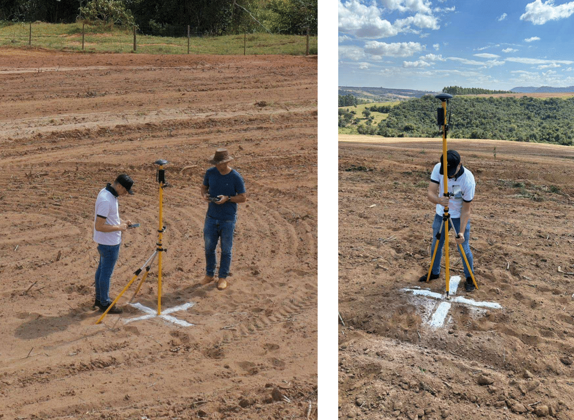
Currently, the Polaris S100 GNSS RTK Receiver is our main equipment, serving us very efficiently in the RTK system, via Radio and NTRIP, providing great performance in the field, even in places with a lot of vegetation, bringing versatility in using the cell phone as a collector, and practicality in using the power bank to power the receiver.
Below are some records of the use of the Polaris S100 GNSS RTK Receiver in the field.
*** Original ***
Me chamo Guilherme G. A de Carvalho, sou Geógrafo, Eng. Agrimensor, proprietário da empresa Terra Uso Ambiental, e junto com minha esposa Thais O. Basso, Eng. Florestal, atuamos em diversos serviços topográficos, como, levantamento planialtimétrico, retificação de imóveis, usucapião, desmembramento, georreferenciamento, SIGEF, locação, estaqueamento de obras, estudo de áreas, loteamento, REURB, cadastro imobiliário, geoprocessamento, banco de dados geográfico, cadastro ambiental rural e estudos ambientais.
Atualmente o Receptor GNSS RTK Polaris S100 é o nosso principal equipamento, nos atendendo com muita eficiência no sistema RTK, via Rádio e NTRIP, proporcionando um grande desempenho em campo, mesmo em locais de muita vegetação, trazendo versatilidade na utilização do celular como coletora, e praticidade na utilização do power bank para alimentar o receptor.
Segue abaixo, alguns registros da utilização do Receptor GNSS RTK Polaris S100 em campo.
From a Customer in Spain
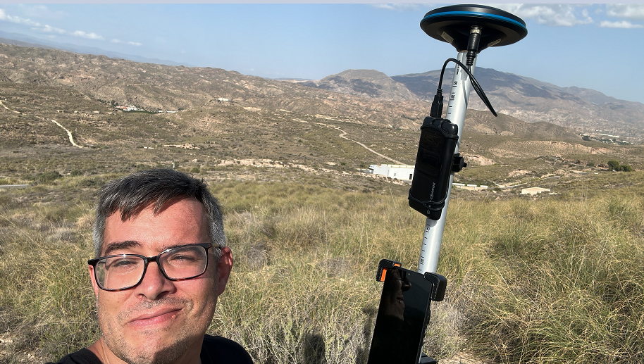
My name is Rafael Soler Rocha, and I work as a GIS & Geomatics officer in the Commercial Archaeology and Heritage industry. I am from Spain where I develop part of my research career but I also work in the UK.
I use my S100 for Archaeological and Topographic survey in the context of both, small and large archaeological areas. That also includes surveying in ground control points for UAV photogrammetric survey. RTK correction services are always used thanks to the base-stations net provided by the Spanish National Geographic Institute 'IGN' (please click on the following link for further information https://www.ign.es/web/gds-gnss-tiempo-real ). For mount point solutions, I principally try to connect to VRS3 and VRS3M networks when available, otherwise RTCM is also an option.
I have been a Trimble user for a long time, and the first thing I would like to highlight is the fact that, as a GNSS Solution, Polaris S100 performs as accurate as most of Trimble equipment, and even faster when it comes to transferring NMEA data and connecting to base stations for RTK fixed corrections. I purchased my S100 in September 2023 and since then I have tested its horizontal and vertical accuracy in different scenario by using RTK corrections through software such as Survey Master, QField, Mobile Topographer, and as a Stand-Alone GNSS with ArcGIS Field Maps and Survey123. The results are very successful, that’s why I have decided to migrate part of my flows and give a central role to my new S100 instead of, for example, getting a Trimble DA2 with Catalyst, which was my original idea. And with regards to this opportunity, I strongly believe that using Field Genius for Android with my S100 would make the difference, especially for those scenario where capturing orthometric heights is a must. I am currently undertaking a research programme on LiDAR and other Remote Sensing techniques applied to Archaeology, and in combination with UAV my Polaris S100 has become the key to the workflow not only to cover large survey areas but also to check in situ the reliability of potential LiDAR anomalies.
From a Customer in Bulgaria
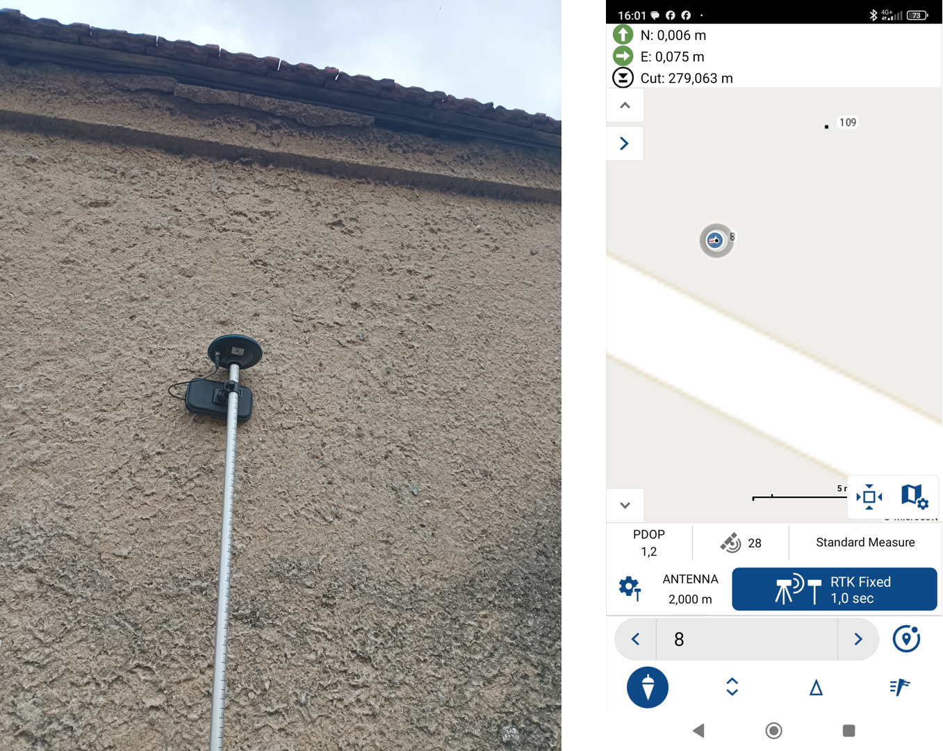
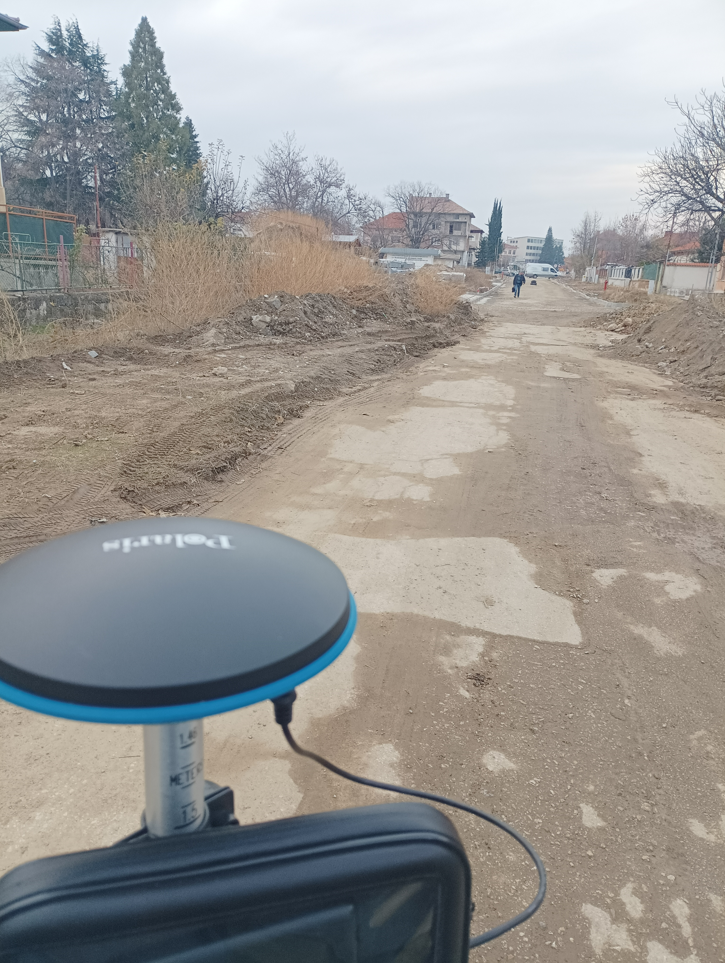
My name is Ivajlo Ivanov. I am a surveying engineer from Bulgaria. I use the Polaris S100 mainly as an RTK receiver with corrections, supplied by a nationally certified prepaid RTK network providing RTK corrections for GPS, GLONASS, BDS and Galileo satellite systems. I am using a demo version of MicroSurvey Field Genius. I also tested the Polaris S100 as a receiver in static mode with post-processing in Leica Geo Office.
So far, I am extremely satisfied with the product for several reasons:
1. It gives a fixed solution very quickly.
2. There is a fixed solution even under obstacles such as tree branches or building walls nearby (I traced a point with known coordinates in RTK mode and the positional accuracy was on the order of 1-1.5 centimeters).
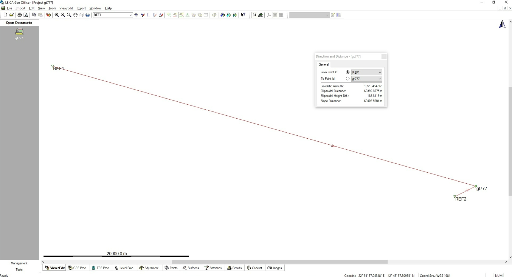
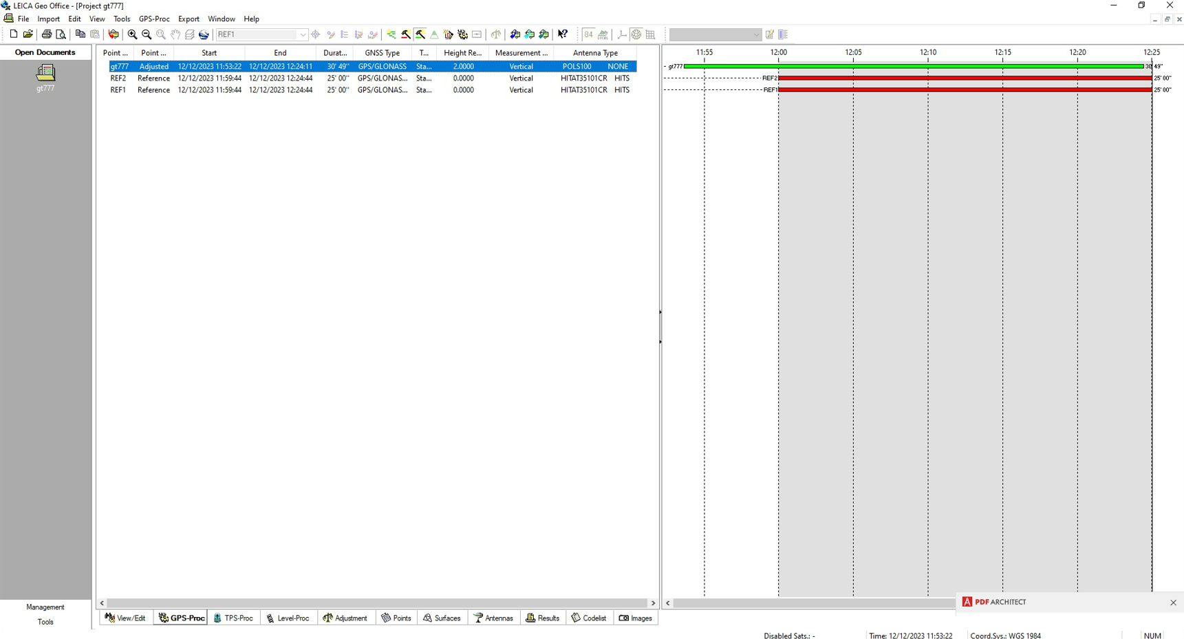
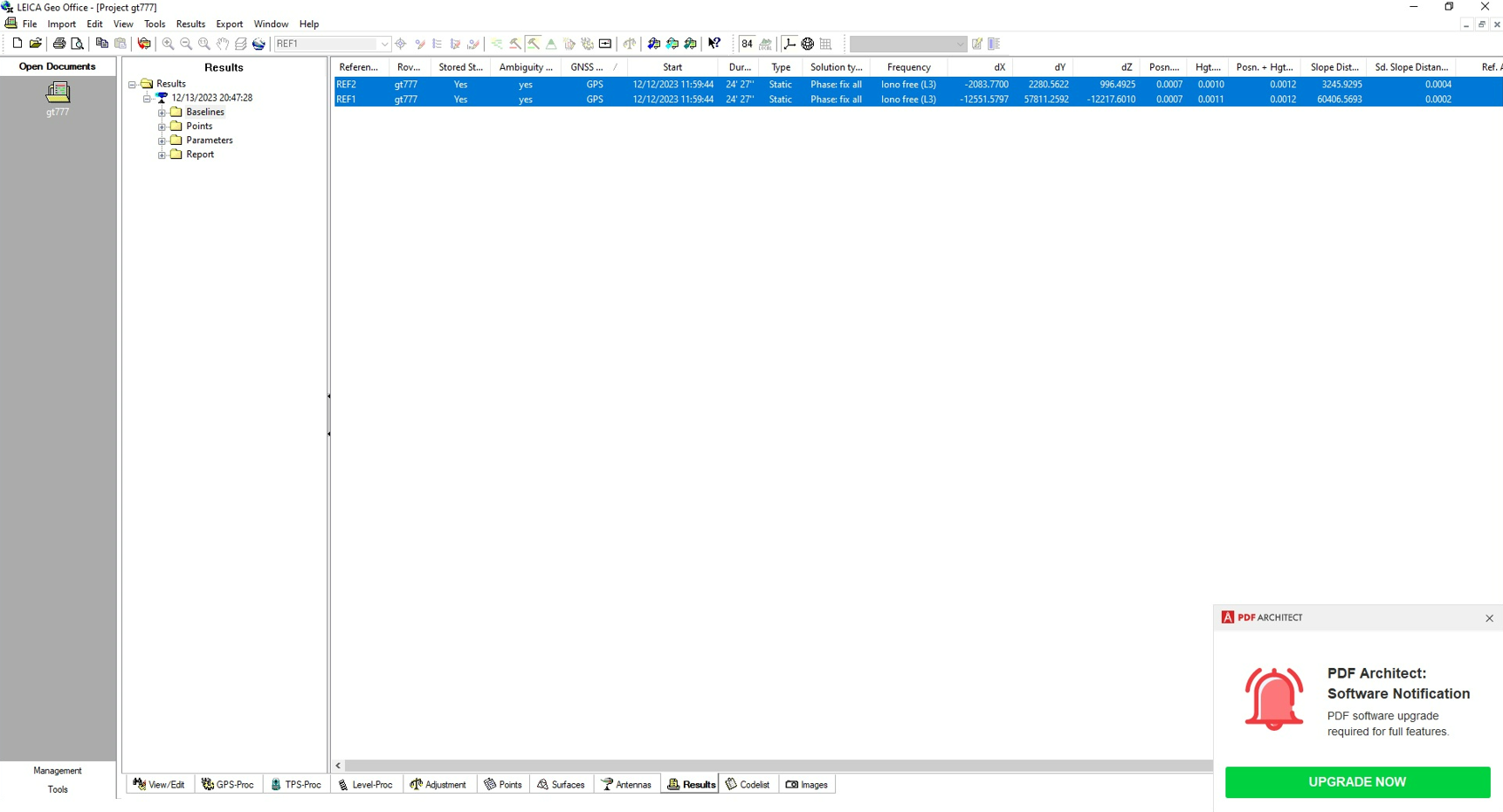
3. I tested the Polaris S100 in static mode by measuring a point (with duration 30 min.), previously determined by precise GNSS measurements, using two permanent stations.
The vector of one of the permanent stations and the measured point has an ellipsoidal length of more than 60 km. After processing the measurements,
I got differences of the order of 2-3 mm by position between the leveled coordinates of the point and the actual coordinates determined by previous more accurate GNSS measurements.
The fact that the antenna has the determination of the variations of the phase centers by the NGS also contributes to the achievement of this accuracy.
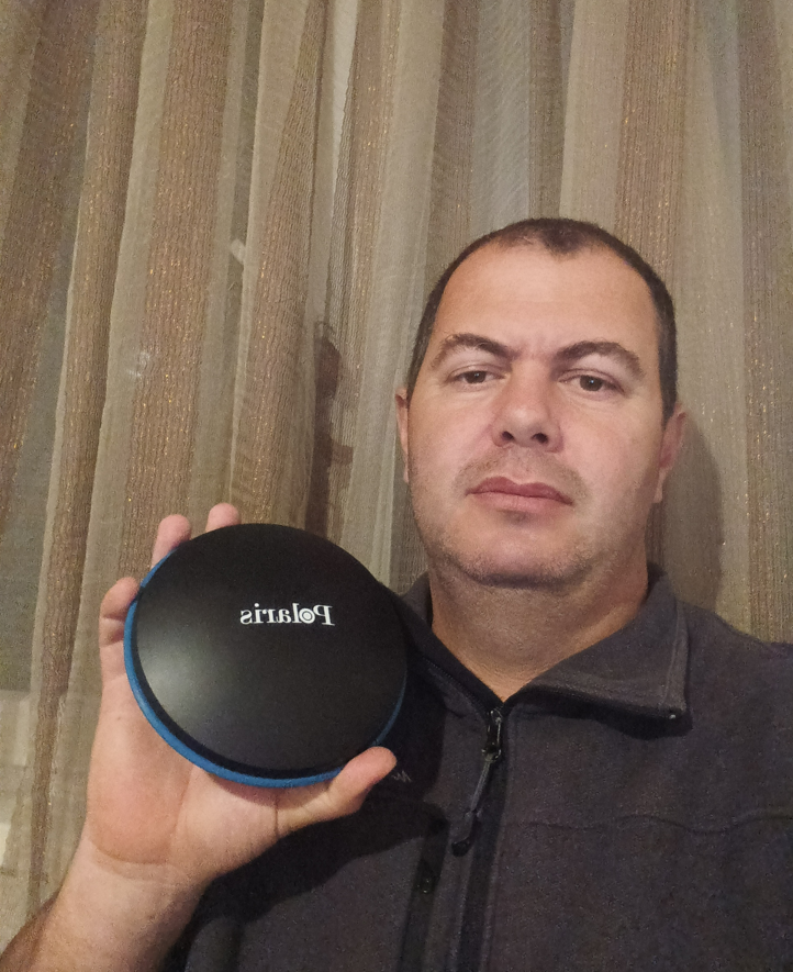
Attached, I am sending photos taken when tracing a point located on the wall of a building, as well as photos taken during the processing of static GNSS measurements.
From our Brazil Distributor
*** Google Translation to English***
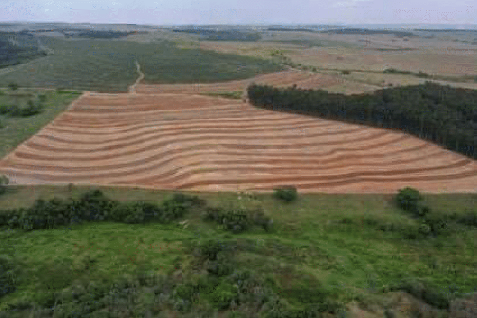
AGRODATA, in partnership with the Piracicaba Regional Comprehensive Technical Assistance Coordination (CATI), carried out the recovery project for a cassava cultivation area in the interior of the state of São Paulo, which in recent years had been suffering from water drainage problems. rain, causing soil erosion.
The objective of the project was to generate contour lines on the land, in order to mitigate the erosion effect that was occurring at the site.
Firstly, the GNSS RTK Polaris S100 receiver was used to track control points to support the aerial survey of the area of interest. 18 control points were collected using the Post Processed, Semi-Cinematic (Stop and Go) survey method and the mapped area was 14 hectares.
After the first mapping stage, the project was generated with the terrain contour lines. Therefore, the Polaris S100 was used again to locate the generated contour lines. More than 600 points were rented in just a few hours of work. For the point location work, three Polaris S100 units were used, one configured as a Base, and the others as Rover, using the real-time correction system via radio.
So with the Polaris S100, a job that would take several days to complete was completed in just 2 days in an easy, quick and very practical way.
*** Original ***
A AGRODATA em parceria com a Coordenadoria de Assistência Técnica Integral (CATI) Regional Piracicaba, realizou o projeto de recuperação de uma área de cultivo de mandioca no interior do estado de São Paulo, que nos últimos anos estava sofrendo com o problema de escoamento das águas da chuva, causando erosões no solo.
O objetivo do projeto foi a geração de curvas de nível no terreno, a fim de mitigar o efeito de erosão que estava acontecendo no local.
Primeiramente o receptor GNSS RTK Polaris S100 foi utilizado no rastreio de pontos de controle para apoiar o aerolevantamento da área de interesse. Foram coletados 18 pontos de controle utilizando o método de levantamento Pós Processado, relativo Semi Cinemático (Stop and Go) e a área mapeada foi de 14 hectares.
Após a primeira etapa de mapeamento, foi gerado então o projeto com as curvas de nível do terreno. Dessa forma, o Polaris S100 foi utilizado novamente para realizar a locação das curvas de nível geradas. Foram locados mais de 600 pontos em poucas horas de trabalho. Para o trabalho de locação dos pontos, utilizou-se três unidades do Polaris S100, sendo uma configurada como Base, e as demais como Rover, utilizando o sistema de correção em tempo real via rádio.
Assim com o Polaris S100, um trabalho iria demorar vários dias para ser finalizado, foi concluído em apenas 2 dias de forma fácil, rápida e muito prática.
From a Customer in Greece
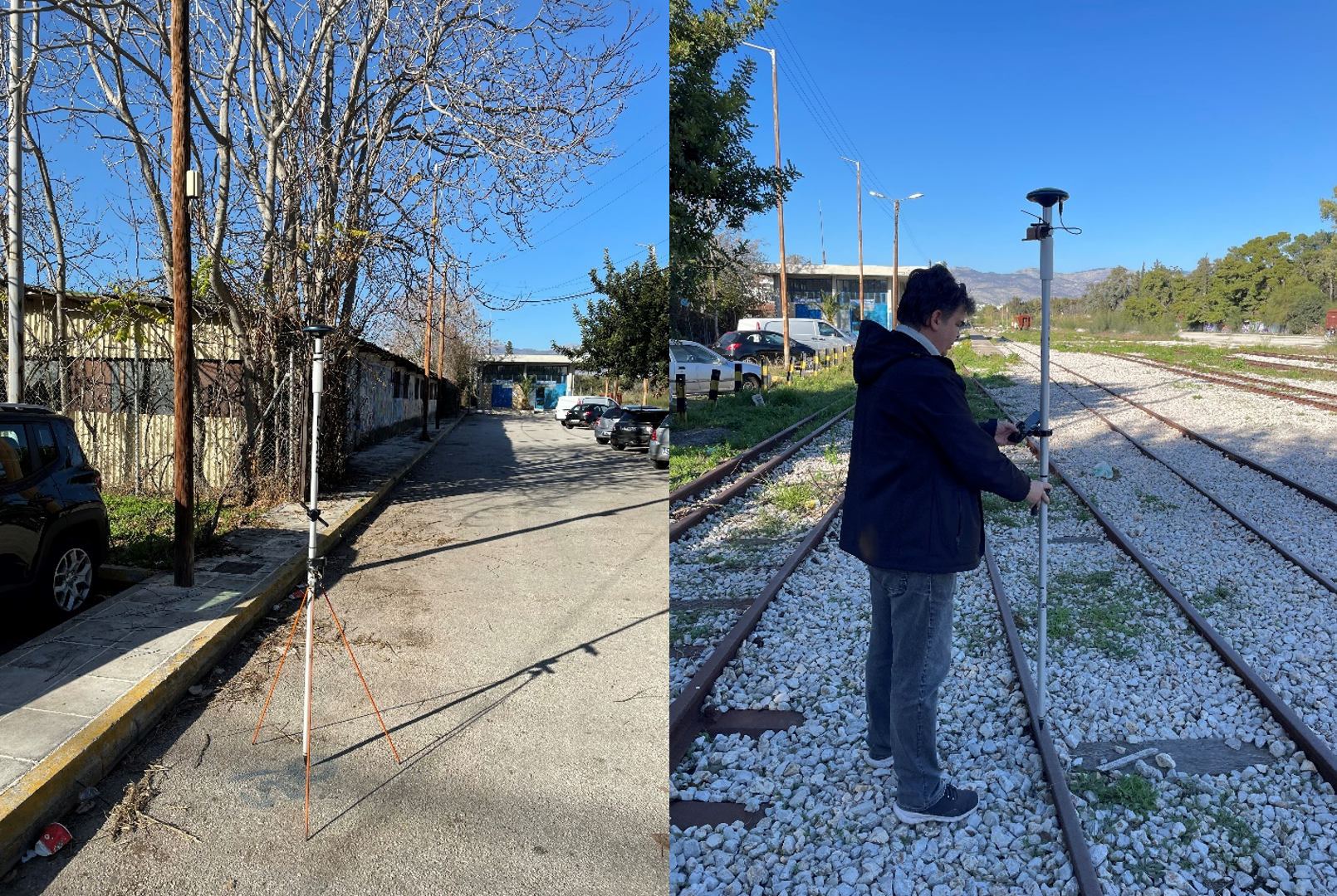
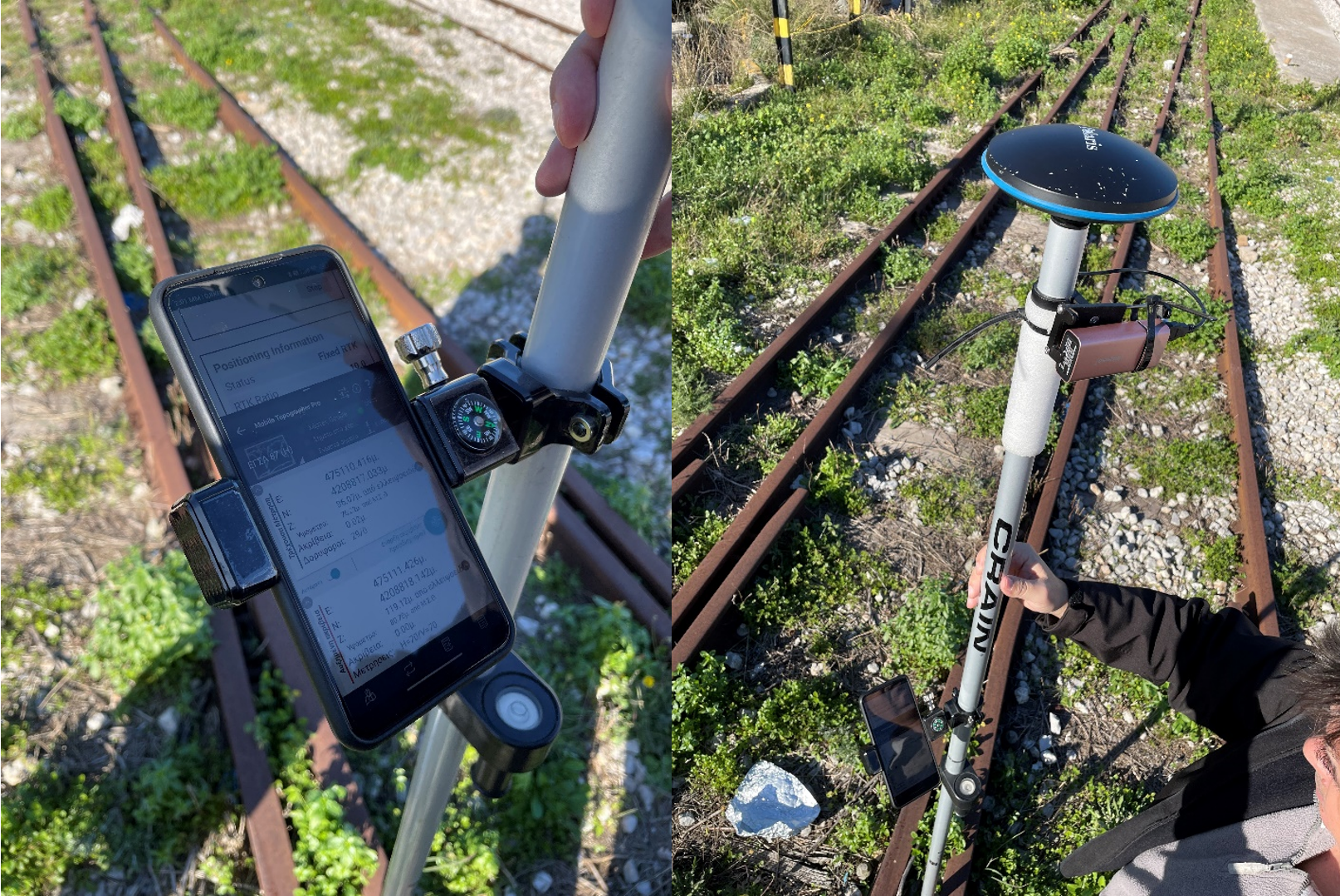
My name is Vasileios Bonovas and I am a land surveyor based in Europe, Greece. I am a land surveyor since 1993 and I was teaching land surveying for 14 years in the University of Western Attica (fromerly ATEI of Athens).
I bought 2 Polaris GNSS S100 in the early 2021 and from then, I use them every single time, as my main equipment, in construction sites and land surveying work.
Until now, I am using them with the combination of 2 apps (‘Polaris connect’ & ‘mobile topographer’). In the construction sites, I use them as base rover (I setup a local fixed base) and I always have fix results. For the land surveying work, I use it as ‘receiver RTK’ combined with the ‘HxGN SmartNet’ network and it is a matter of seconds to have fix results. Also, the Polaris GNSS S100 works under difficult situations (close to tall trees), making the job done easier, and more accurately.
In addition to that, the Polaris S100, are easy to use and reasonably priced, making them a value for money GNSS professional equipment.
From a Customer in Brazil
My name is Charles Rodrigo Teixeira, and I am based in Brazil. I use the S100 for precise tracking of coordinates in rural areas, especially for topographic drawings. The use of the S100 is essential to ensure the centimeter-level accuracy required in my work.
When post-processing coordinates, I rely on the IBGE's (Brazilian Institute of Geography and Statistics) PPP (Precise Point Positioning) service. This tool provides additional accuracy and reliability to my work, ensuring that the coordinates are correct and aligned with the required geodetic standards.
My choice of the S100 was based on its ability to meet all my centimeter-level accuracy needs. Additionally, the affordable cost of the Polaris S100 device was a decisive factor, making it a highly advantageous option compared to other solutions available in the market.
In summary, the S100 not only provides the necessary accuracy for tracking coordinates in rural areas but also offers excellent value for money. Its combination of reliable performance and affordability has made it an essential choice for optimizing my professional practice in topog.
From a Customer in Mexico
I’m Javier Issrael Martinez Carrazco from Mexico.
I have been use S100 for RTK in proyect of wáter pipe and sanitary, to take data of levels to proyect of volumetry, to do fotogrametry with drones, and to remake lands or properties limits.
Using S100 for RTK to fixed base, I use SIX MONTH FLOATING IP RTK BASE REDIRECT SERVICE of Polaris, and EMLID data.
I consider S100 first for the price and second then it is fast and as good as other gps equipment in the market. I wander with S100 because the grand distance signal between base and rover, sometime is not necesary to change base, and this for me is awsome.
*** Customer Usage Example End ***
S100 is designed mainly for network RTK rover application, with RTK base and data logging post-processing function as secondary bonus function. Below are some considerations for deciding if S100 can be a good choice for you.
Great Choice: Having Access to RTK Correction Service with VRS Support
RTK correction service with Virtual Reference Station (VRS) support interpolates a virtual reference station near the RTK rover based on the NMEA location the rover provides. This eliminates position error that grows with increasing base/rover distance. When used with VRS base, the RTK performance difference between S100 and an expensive RTK receiver is little.
Good Choice: Having Access to RTK Correction Service with Nearest or Single Reference Station Support
RTK correction service with Nearest Reference Station (NRS) support assigns a nearest reference base station to use with the rover based on the NMEA location the rover provides. When used with RTK correction service having only Single Reference Station (SRS) support, user need to manually choose which nearest reference base station to use. Both has position error that grows with increasing base/rover distance.
For user in location with lower ionospheric activity 24/7 (Europe, North America) the RTK performance difference between S100 and an expensive RTK receiver is small.
For user in location with ionospheric activity that can vary between high and low across different time of day, using S100 with NRS and SRS base having long base/rover distance might experience RTK Fix difficulty when the ionospheric activity is high, while other brands might also have RTK Fix difficulty, give incorrect result, or able to still work, dependent on base/rover distance and severity of ionospheric activity. If having such issue, the best approach with S100 would be setting up a local S100 RTK base to use with the S100 RTK rover, using NRS/SRS base to establish locally setup base location coordinates when the ionospheric activity is low, then this RTK Fix difficulty issue with long base/rover distance at time of high ionospheric activity would be eliminated. Since the price of two S100 is still lower than most other RTK receivers, S100 would still be a nice choice for customers that don’t mind setting up a local RTK base.
Not A Good Choice: Having No Access to RTK Correction Service
When having no access to RTK correction service, S100 can still be used for RTK surveying using approach described in below blog. As it involves S100 RTK base logging raw measurement data for hours while doing RTK surveying, to later upload to online PPP service to determine the exact S100 RTK base location, it’s less time efficient than RTK receivers that support L-band satellite delivered correction service. For this usage situation S100 would not be a good choice.
https://www.polaris-gnss.com/blog/rtk-survey-without-using-gnss-correction-service
Not A Good Choice: Usage Under Tree Canopy
Tree canopy situation can vary a lot depending on the actual environment. Whether RTK receiver works under tree canopy is highly environment dependent, there is no simple clear-cut answer. To a degree, all RTK receivers would not work under very dense forest canopy. To avoid dealing with S100 product return due to unable to get RTK Fix under heavy tree canopy issues, we don't advertise S100 as being able to work well under tree canopy. For this usage situation S100 would not be a good choice.
Not A Good Choice: Post-Processing
S100 can log RTCM raw measurement data, to be later converted to standard RINEX format to use with 3rd party post-processing software. Since we don't offer post-processing software, we are less able to provide technical support on 3rd party post-processing software. For this usage situation S100 would not be a good choice.